|
Variable name |
Dimensions |
Unit |
Description |
| time |
time |
days/hours/minutes/seconds since YYYY-MM-DD HH:MM:SS |
time |
| FORC_TIME_STEP |
|
s |
forcing time step |
|
LAT |
Number_of_points |
degrees |
latitudes |
|
LON |
Number_of_points |
degrees |
longitudes |
| UREF |
Number_of_points |
m |
Reference_Height_for_Wind |
| ZREF |
Number_of_points |
m |
Reference_Height |
| ZS |
Number_of_points |
m |
surface orography |
| Tair |
time, Number_of_points |
K |
air temperature |
| Qair |
time, Number_of_points |
Kg/Kg |
air specific humidity |
| Wind |
time, Number_of_points |
m/s |
wind speed |
| DIR_SWdown |
time, Number_of_points |
W/m2 |
downward direct shortwave radiation |
| SCA_SWdown |
time, Number_of_points |
w/m2 |
downward diffuse shortwave radiation |
| LWdown |
time, Number_of_points |
W/m2 |
downward longwave radiation |
| PSurf |
time, Number_of_points |
Pa |
surface pressure |
| Rainf |
time, Number_of_points |
Kg/m2/s |
rainfall rate |
| Snowf |
time, Number_of_points |
Kg/m2/s |
snowfall rate |
| CO2air |
time, Number_of_points |
Kg/m3 |
CO2 concentration |
| Wind_DIR |
time, Number_of_points |
deg |
wind direction |
Dimensions
Number_of_points and
time represent respectively the total number of gridboxes in the area of interest and the number of atmospheric time steps.
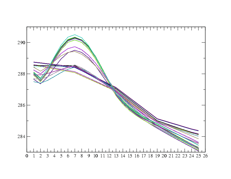
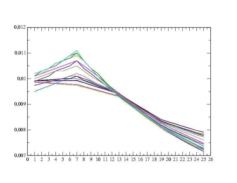
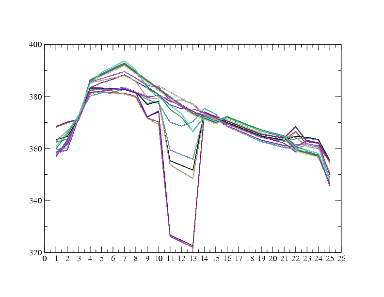
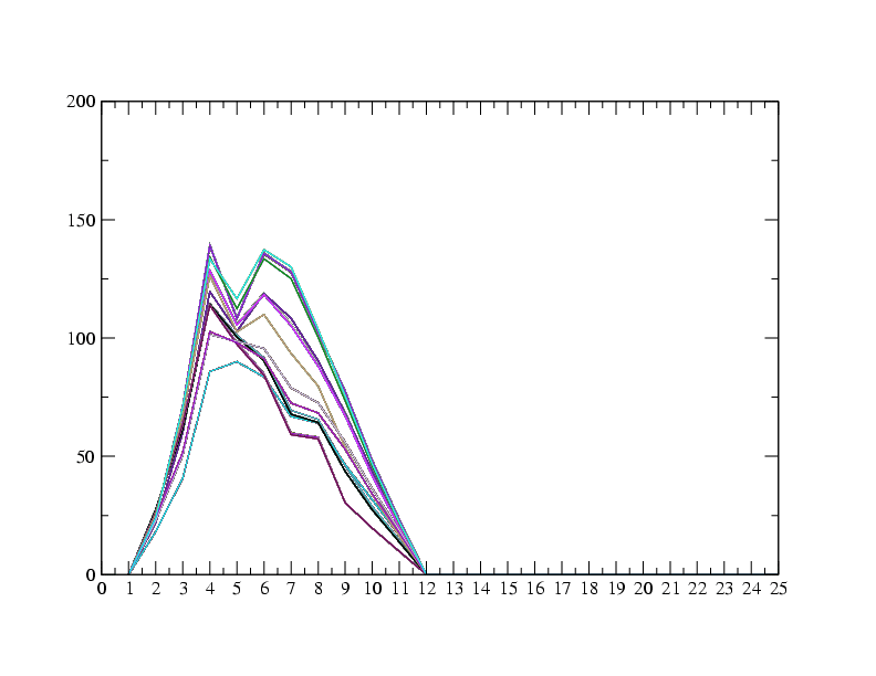
The following pictures show the time evolution of forcing quantities for the integration period, over the region of interest. Each curve correspond to a grid point.
Figure 3.1:
Time evolution of temperature over the working area
|
|
Figure 3.2:
Time evolution of specific humidity over the working area
|
|
Figure 3.3:
Time evolution of longwave incoming radiation over the working area
|
Figure 3.4:
Time evolution of shortwave incoming radiation over the working area
|