|
|
|


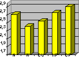
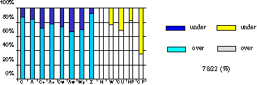
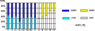
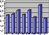
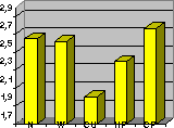
Figure 1. The frequency of the occurrence of the different synoptic and extreme situations
The precipitation distribution is the best ranked parameter in this evaluation period. The forecast of the temperature, chiefly the maximum temperature is the less successful.
|
Parameters |
wind |
cloud |
max. temp. |
min. temp. |
precip. distr. |
Precip. Quan. |
|
Evaluation |
2.67 |
2.66 |
2.50 |
2.55 |
2.72 |
2.60 |
Table 1. The rate of successful forecast of the different parameters
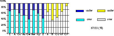
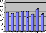
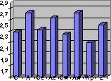
Wind : The ranks are the best in the case of anticyclonic and weak pressure gradient weather situations, or when it was cold air pad in the Carpathian Basin. The prediction is the worst in strong wind periods, it is significantly underestimated, like in the last year. The rate of the overestimations is far bigger than the rate of the underestimations.
|
| |
The rate of the successful forecasts | |
|
| |
The rate of the overestimated/underestimated cases (%): Figure 2. Subjective verification of wind forecasts in the case of the different synoptic and extreme situations | |

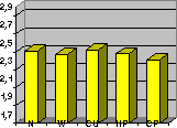
When the cloud coverage is the predicted parameter, the rate of successful forecasts is the best in cyclonic and in zonal flow situations. Studying the extreme situations it can be seen, that the rank is the best in strong wind episode, and chiefly in heavy precipitation situation. It is the worst significantly in cold air pad weather situation. The model overestimates the cloudiness in many cases.
The rate of the successful forecasts
The rate of the overestimated/underestimated cases (%) Figure 3. Subjective verification of cloudiness forecasts in the case of the different synoptic and extreme situations |
The forecast of the maximum temperature is the worst in zonal flow situation (when there is a rapid temperature change at high levels). The forecast is not always successful in the case of anticyclone or Western part of anticyclone. In autumn and in winter in anticyclonic weather situation cold air pad very often occurs, it may cause the wrong prediction. Last year the ALADIN model predicted much more low degrees in the most cases. In this evaluation period, in 1998 the difference is not so big between the rate of the overestimation and underestimation.
The rate of the successful forecasts | |
The rate of the overestimated/underestimated cases (%) Figure 4. Subjective verification of maximum temperature forecast in the case of the different synoptic and extreme situations | |
Studying the minimum temperature forecast we can draw similar conclusion like in the case of maximum temperature. The worst ranks were given in zonal flow situation and when it was cold air pad. In 1998 the rate of underestimation also was bigger than the rate of overestimation, but not so much like in 1997.
The rate of the successful forecast |
The rate of the overestimated/underestimated cases (%) Figure 5. Subjective verification of minimum temperature forecast in the case of the different synoptic and extreme situations |
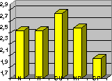
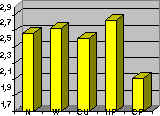
Apart from the anticyclonic situation the most successful forecasts are in Ae (Eastern part of anticyclone) and in cyclonic situation. The rate of successful forecasts is the worst in zonal flow or in weak pressure gradient situation. As the strong convection event connects with the weak pressure gradient weather situation in many times, studying the extreme situations it can be seen, that the ranks are the worst in Cu (strong convection event) weather situation.
The rate of the successful forecasts Figure 6. Subjective verification of precipitation distribution forecast in the case of the different synoptic and extreme situations |


The predicted amounts of precipitation are not good neither in cyclonic, nor in weak pressure gradient situation. When there is strong convection event, the forecast of the model is not successful, at all. The rate of the overestimation/underestimation shows, that the precipitation forecast is overestimated in many cases.
The rate of the successful forecasts |
The rate of the overestimated/underestimated cases (%) Figure 7. Subjective verification of precipitation quantity forecasts in the case of the different synoptic and extreme situations |
Studying the regions separately it can be seen, that the forecast of almost every element is better for the Western part of Hungary, but the difference is not big.
region |
wind |
Cloud |
max.temp |
Min. temp |
precip. dist |
precip. q. |
East |
2.71 |
2.67 |
2.50 |
2.53 |
2.71 |
2.59 |
West |
2.62 |
2.67 |
2.51 |
2.56 |
2.73 |
2.61 |
Table 2. The results studying separately the different regions and forecast ranges
